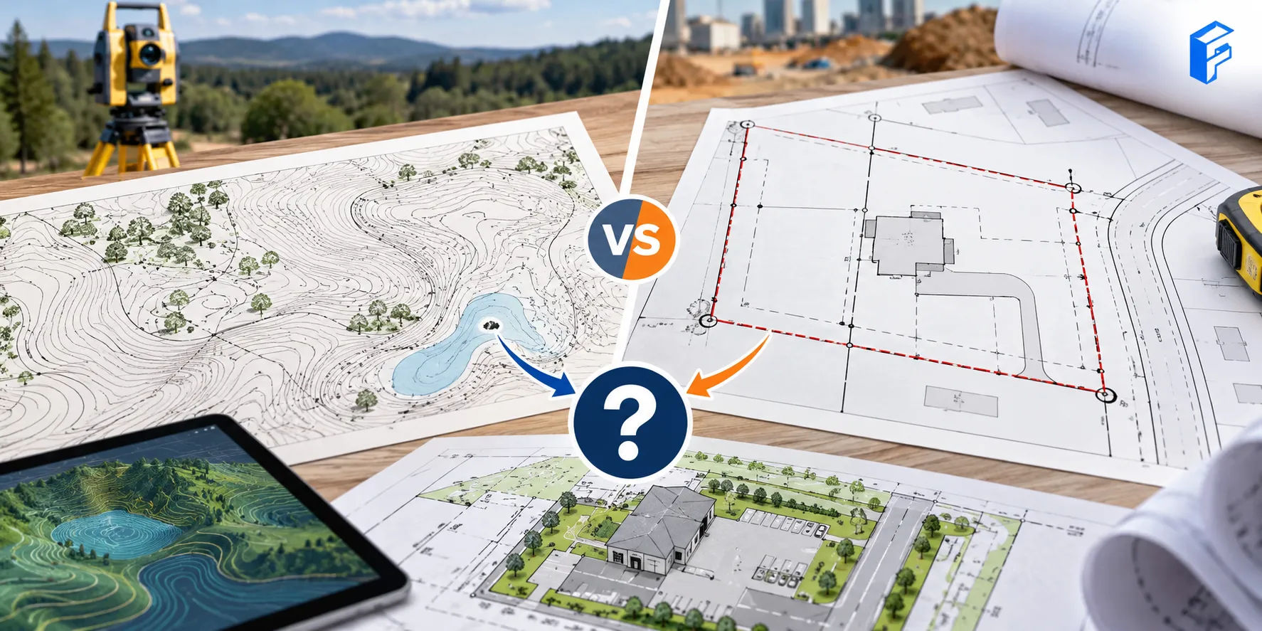
“We already have a survey” is one of the more common and more misleading things said about a site before design work starts. A boundary survey and a topographic survey answer two completely different questions, and having one on file says nothing about whether you have the other. A land-surveying resource puts the distinction cleanly: a topographic survey describes a property’s physical characteristics, while a boundary survey establishes its legal lines. Neither one substitutes for the other.
A boundary survey establishes legal property lines, corners and encroachments — what real estate transactions and title work rely on. A topographic survey maps physical features — elevation, contours, trees, utilities — and is what site design and drainage planning rely on. Most development site plans need both; having one on file doesn’t mean you have the other.
Who this is for
Developers and civil engineers trying to figure out which survey type an existing document on file actually is, and whether a new project needs to commission the other one.
What does each survey actually show?
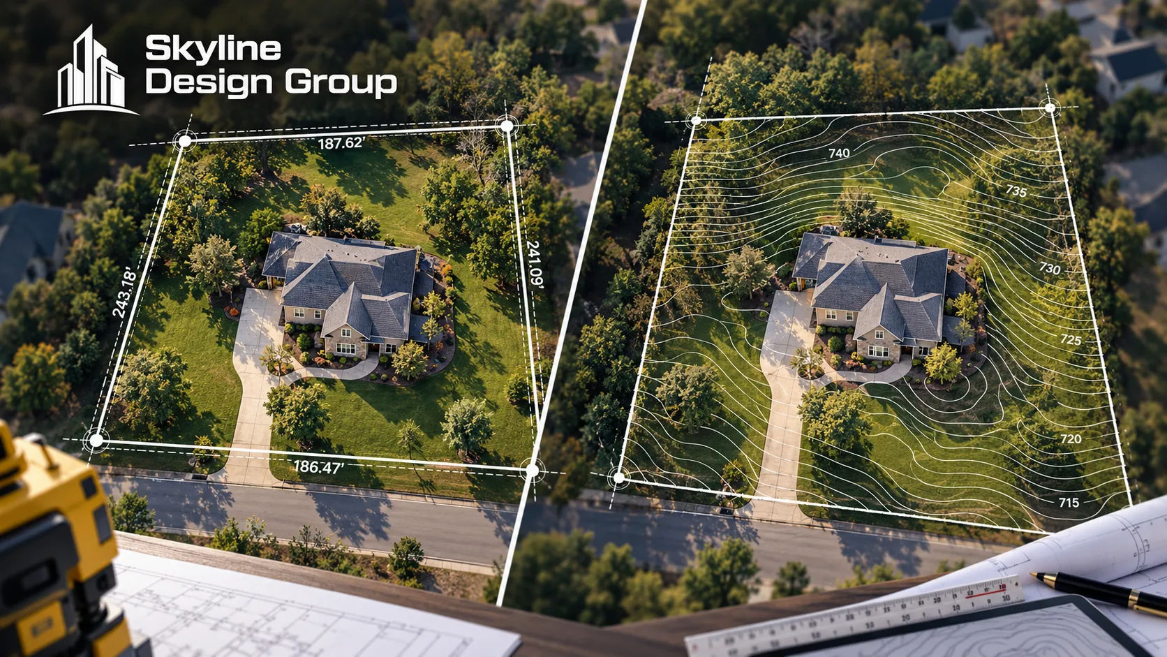
A boundary survey references deeds, plats and legal documents to establish a property’s legal demarcation — where the lines actually are, where the corners sit, and whether anything is encroaching across them. It’s the document real estate transactions, mortgage approvals and boundary dispute resolution depend on, because it answers a legal question: where does this property actually end.
A topographic survey answers a physical question instead: what does the land itself look like. It measures elevation and depicts it through contour lines, and documents existing features — trees, water bodies, utilities, structures — that matter for how a site can actually be built on, graded or drained. One land-surveying source frames the practical difference simply: developers and builders rely on topographic data to plan construction placement, drainage and landscaping that works with the terrain that’s actually there, not an assumed flat lot.
| Boundary survey | Topographic survey | |
|---|---|---|
| Answers | Where are the legal property lines? | What does the land’s surface actually look like? |
| Typically used for | Real estate transactions, title work, resolving disputes | Site design, grading, drainage, environmental assessment |
| Who relies on it most | Buyers, lenders, title companies, attorneys | Civil engineers, architects, developers planning construction |
| Shows | Corners, lines, encroachments | Contours, elevation, trees, utilities, structures |
Why a single survey often doesn’t cover both
This isn’t an oversight — it’s how survey scope typically works. As covered in more detail in a companion article on this site, the industry standard for a land title survey treats contour and elevation information as an optional item that has to be specifically requested and paid for, separate from a survey’s baseline boundary and title requirements. A boundary survey ordered for a real estate closing was very likely never intended to carry topographic detail, and checking for it after the fact — rather than assuming it’s there — is the only way to find out before relying on it for design.
The reverse gap exists too. A topographic survey focused on terrain and features doesn’t automatically carry the same legal weight or precision on property lines that a dedicated boundary survey does, since establishing legal boundaries with the confidence a transaction or permit needs is its own specific scope of work.
That gap is easy to miss precisely because both documents can look equally professional and detailed. A richly featured topographic survey with no boundary data can feel more complete than it is, simply because there’s more visual information on the page.
When does a site plan actually need both?
Most development projects do, and for reasons that don’t overlap. The design side needs topographic data to plan grading, drainage and building placement against real terrain. The legal and permitting side needs boundary data to confirm the design actually fits within the property’s legal limits and doesn’t encroach on a neighboring parcel or an easement. A site plan built on topographic data alone can be beautifully designed and still violate a setback nobody checked. A site plan built on boundary data alone can respect every legal line and still ignore a slope or drainage problem that makes the design unbuildable as drawn.
Where this fits into a production partner’s scope
If you’re not sure whether an existing survey covers boundary, topographic data, or both, Request a Scope Review — send what you have and get back a clear read on what it actually includes and what’s missing for your site plan.
For how topographic data gets requested and what a properly digitized file should contain, see topographic survey digitization explained. For what to check in any survey file before designing from it, see 6 things to check in a survey file.