The assumption is reasonable on its face: the measurements on an old paper survey were accurate when they were taken, so scanning and tracing it into CAD should just carry that accuracy forward. Two things complicate that assumption, and neither one is about whether the original surveyor did good work. One is what coordinate system those measurements were tied to. The other is what happened to the paper itself in the decades since.
Measured distances and bearings on an old paper survey usually transfer accurately into digital form when done carefully. What doesn’t transfer automatically: the coordinate datum (an old NAD27-based survey doesn’t line up with modern NAD83 without conversion, sometimes off by hundreds of feet), and the paper itself, which stretches over time and through photocopying, throwing off scale unless corrected for.
Who this is for
Civil engineers who have an old paper survey — sometimes decades old, sometimes predating the design software currently in use — and need to know what’s actually reliable once it’s digitized versus what needs independent verification.
What actually transfers cleanly?
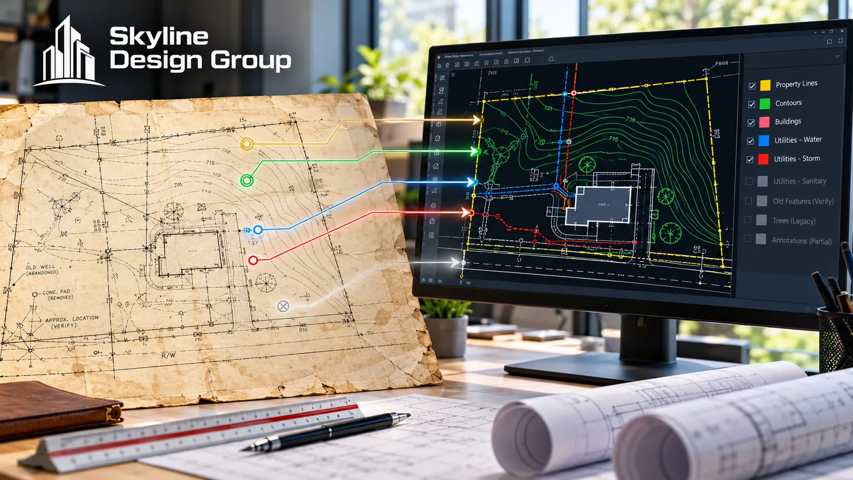
The underlying measurements, mostly. A guide on converting old maps and drawings into CAD is specific about what carries over reliably once a source is properly calibrated: geometric coordinates and dimensions, spatial positioning and scale relationships, and even layered thematic data that can become separate CAD layers from a single source drawing. If a surveyor recorded a bearing and a distance accurately in 1965, that bearing and distance are still accurate today — digitizing doesn’t change what was actually measured.
The same guide is equally direct about what doesn’t come across automatically: semi-automatic tracing tools can vectorize maybe 70 to 80 percent of an ideal source image on their own, but crossed lines, complex areas and hand-drawn irregularities still need manual correction. No automated conversion process gets to 100 percent without a person checking it.
What doesn’t transfer automatically — the coordinate datum
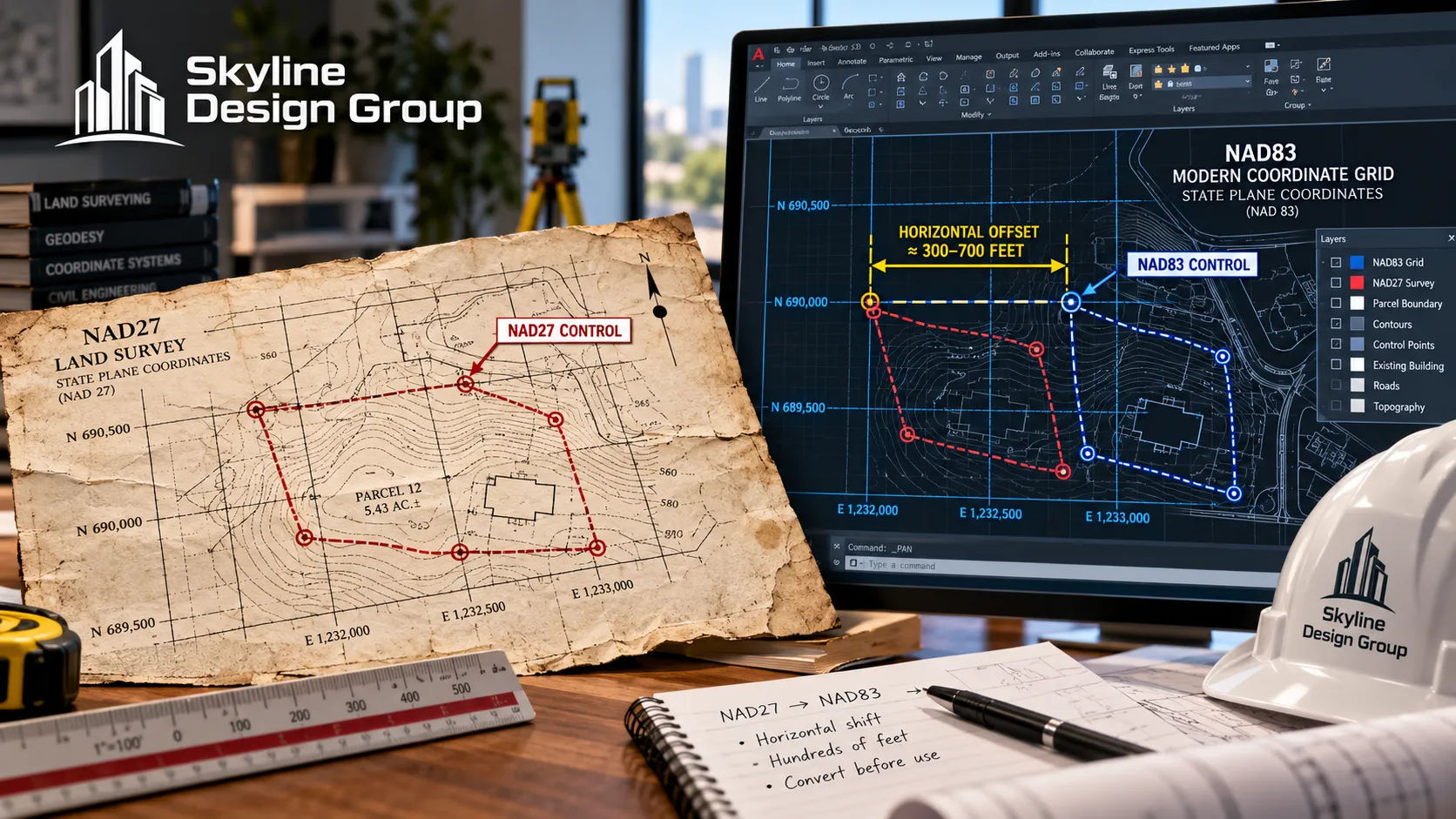
This is the less obvious problem, and it’s about geography, not the drawing itself. A retired National Geodetic Survey geodesist’s explanation of the issue is specific: NAD27, the older North American reference datum many historical surveys were tied to, carries reference-station errors that can reach tens of feet relative to the datum’s own axes, and when NAD27-based coordinates get compared against modern NAD83 coordinates — which is what GPS receivers output today — the discrepancy can exceed 300 feet.
That’s not a rounding error. A survey digitized without correcting for its original datum can look perfectly precise on screen and still be badly misaligned with a modern coordinate system the moment it’s combined with GPS-based data, a current site survey, or any other NAD83-referenced dataset. Conversion tools exist specifically for this — NADCON and CORPSCON are both cited as standard transformation software — but the conversion has to actually happen, not get assumed away because the drawing looks fine on its own.
What doesn’t transfer automatically — the paper itself
The second problem is physical, not geographic. Paper stretches and distorts over time, and every photocopy made along the way adds its own additional distortion on top of whatever the original paper had already picked up. A survey that’s gone through one or two generations of copying before reaching a scanner isn’t the same physical object as the original drawing, even though it looks identical.
The practical fix is the same recommendation the conversion guide makes for any source material: compare known dimensions on the original against the digitized result, rather than assuming the scale held. If a drawing has any printed or known reference dimension, checking that dimension against what the digitized file reports is the fastest way to catch distortion before it gets built into a design.
| Element | Transfers cleanly? | What to watch for |
|---|---|---|
| Measured bearings and distances | Yes, if the original surveying was accurate | Verify against any known reference dimension after digitizing |
| Overall drawing scale | Not automatically | Paper stretch and photocopy generations distort scale over time |
| Coordinate datum (e.g., NAD27) | No | Requires explicit conversion (NADCON, CORPSCON) before combining with modern data |
| Hand-drawn annotations and labels | Partially | Automated tracing misses 20-30% even on good source material; needs manual review |
Where this fits into a production partner’s scope
If you have an old paper survey that needs digitizing, Request a Scope Review — send what you have, including any visible datum notes, and get back a specific read on what will transfer cleanly and what needs correction first.
For the general process of turning any flat or outdated survey into a usable CAD file, see topographic survey digitization explained. For what to check in any survey file before designing from it, see 6 things to check in a survey file.