
HOME UNITS Residential Site Layout Plan
A detailed residential development layout showing the arrangement of multiple home units, internal roads, lot boundaries, open spaces, and surrounding site features. The plan presents the overall subdivision design with unit numbering, road alignment, green/common areas, boundary lines, and engineering reference details for planning and construction purposes.
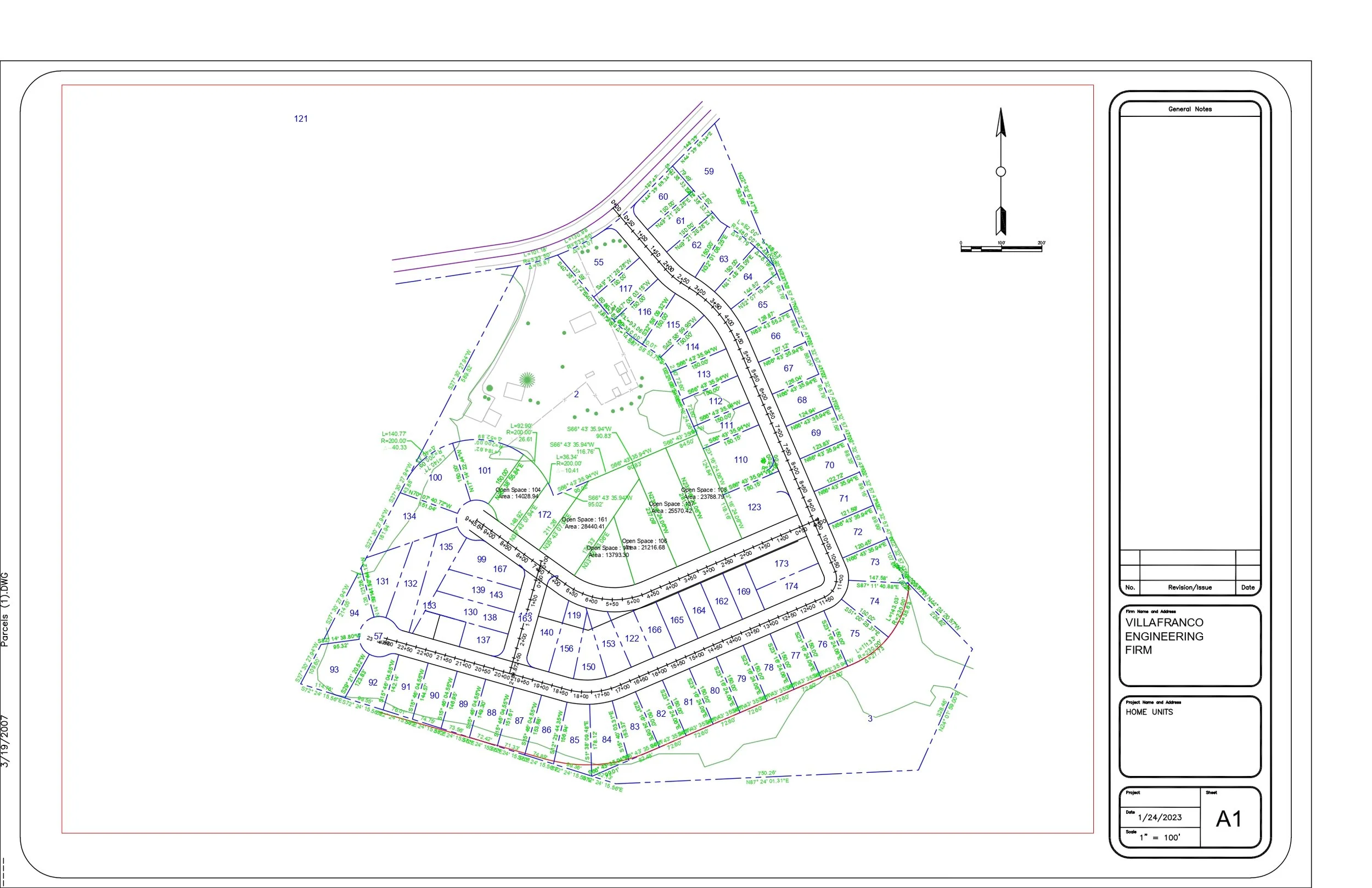
Home Units Site Plan
This drawing presents a civil engineering site plan for a residential development labeled Home Units. The sheet shows the overall layout of the property, including proposed lots, internal roadways, contour information, boundary lines, and key site design details. The plan is organized in a professional engineering sheet format with a north arrow, graphic scale, notes area, revision table, and title block.
Overall Site Layout
The main drawing area shows a grouped residential subdivision layout. Multiple home units or lots are arranged around an internal roadway network, forming a compact neighborhood-style development. The layout helps identify how each unit is positioned within the overall property boundary.
Lot and Unit Arrangement
The plan includes numerous numbered lots or home units distributed throughout the site. Each lot is outlined and labeled, showing the proposed organization of residential parcels. This information is useful for planning, permitting, sales documentation, and construction coordination.
Internal Roadway Network
A central roadway system runs through the development and connects the individual lots. The roads are shown with defined edges and curves, helping illustrate site access, circulation, and the relationship between the residential units.
Property Boundary
The outer boundary of the site is shown with linework surrounding the development area. This boundary defines the limits of the project and separates the proposed home-unit layout from adjacent land or surrounding features.
Existing Terrain and Contours
Contour lines and elevation markings are shown across the site, indicating changes in ground elevation. These details help explain the natural slope of the land and support grading, drainage, and roadway design decisions.
Grading and Spot Elevations
The plan contains many elevation labels and grading notes throughout the lots and roadways. These values help guide how the land should be shaped during construction and show how finished grades may relate to the existing terrain.
Drainage and Site Flow
The contour information and grading labels help indicate how stormwater may move across the property. These details are important for identifying drainage paths, low areas, and areas where stormwater management features may be required.
Access and Circulation
The internal road layout provides vehicle access to the proposed home units. The plan shows how traffic can move through the site and how the development connects to surrounding roads or access points.
Scale and Orientation
A north arrow and graphic scale are included near the upper-right portion of the drawing. These elements help users understand the orientation of the site and estimate distances within the plan.
General Notes and Revision Area
The right side of the sheet includes a general notes area and revision table. These sections are used to record project notes, design updates, issue history, and other documentation needed during engineering review or construction.
Project Title Block
The title block identifies the drawing as part of a professional engineering plan set. It includes the firm information, project name Home Units, sheet number A1, date, and drawing scale.
Overall Purpose
Overall, this sheet communicates the proposed layout and grading concept for a residential home-unit development. It combines lot layout, roadway access, site contours, and project documentation to support planning, civil design review, permitting, and construction coordination.